View the North Bend Rail Trail on Google Maps
The North Bend Rail Trail offers a scenic experience with splendid railroad elements and welcoming trail towns to be enjoyed. Stretching nearly 72 miles from Interstate 77 near Parkersburg (Cedar Grove) to Wolf Summit, the trail travels through an impressive 13 tunnels (10 passable), crosses 36 bridges, and passes through or near an assortment of state, county, and local parks. The trail is also part of the 5,500-mile, coast-to-coast American Discovery Trail.
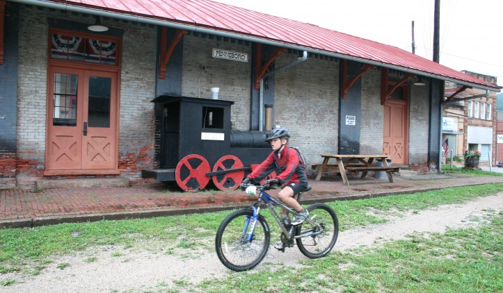
Though it is easily accessible from Interstates 77 and 79, and it runs parallel to US 50, the trail passes through wild and natural areas. You will find an abundance of wildlife, including deer and beaver, and the farmland surrounding the small, rural communities that grew up along the railroad corridor provide prime bird-watching. The North Bend Rail Trail’s many points of interest and history include the former Stage Coach Inn in Pennsboro, a marble factory, hand-blown glass factories, outlet stores, arts-and-crafts markets, fairs and festivals, sites of train robberies, veterans memorials, a bike shop/general store and the legend of the ghost of tunnel 19, the Silver Run tunnel.
In the tumultuous years before the Civil War and the creation of the state of West Virginia, the rail corridor was constructed by the Baltimore and Ohio Railroad between 1853 and 1857. Thirteen of the railroad’s original tunnels remain. The number 10 tunnel, west of Ellenboro, is 337 feet long and is a “raw,” or natural, tunnel, meaning it was bored through solid rock. Many of the tunnels are quite long and require a flashlight or headlamp to safely navigate them.
The true gem of this trail is the stunning natural scenery. Beyond the spectacular bridges and tunnels, the undisturbed beauty you are exploring makes you feel more like the explorers Lewis and Clark than a 21st century hiker. And like those adventurers, you’re likely to have some wildlife encounters, as well. Black bear, bountiful deer, grouse and more may cross your path.
You’ll also encounter other trail users, particularly near the many quaint towns along the trail that have wholly embraced the rail-trail, building eateries that will satisfy even the hungriest of hikers. Towns such as Cairo, Pennsboro and Salem have all had restaurants pop up next to the trail. The locals are happy to share a story of the old rail line, and the staffs welcome even the sweatiest of customers.
Spring makes for a slightly more difficult ride since the surface hasn’t hardened up yet, especially from equestrian use. But as with all trails, the NBRT’s work crew is busy repairing winter damage to ensure good summer and fall riding.
Trail Manager Contact
North Bend Rail Trail State Park
202 North Bend Park Rd.
RR 1 Box 221
Cairo, West Virginia
304-643-2931
http://www.northbendrailtrailstatepark.com/
northbendrailtrail@wv.gov
North Bend Rails to Trails Foundation
P.O. Box 206
Cairo, West Virginia
(304) 592-0177
Website: https://www.nbrtf.com/
Email Contact: info@nbrtf.com
Notes
National Recreation Trail (NRT).
American Discovery Trail
Part of the Industrial Heartland Trail Coalition Parkersburg to Pittsburgh Corridor
Mile marker 42 to 50 has never been paved. Visit: http://northbendrailtrail.org/
North Bend Rails to Trails Foundation- http://northbendrailtrail.net
North Bend State Park- http://www.northbendsp.com
Trail of the Month December, 2015- http://www.railstotrails.org/trailblog/2015/december/09/west-virginias-north-bend-rail-trail/
Six Great Things You’ll See on NBRT- http://www.railstotrails.org/trailblog/2016/april/04/six-great-things-youll-see-on-the-north-bend-rail-trail/