As it weaves past long-abandoned mining towns such as Red Ash and Rush Run, the Brooklyn to Southside Junction Trail tells the unique story of “King Coal” and Appalachia. Once an important transportation corridor used to haul coal from the remote New River Gorge, this recycled railroad corridor now brings new life into the area as a tourist attraction. Never more than 100 yards from the New River, this trail provides users with an up-close look at the natural beauty found within and along the New River Gorge National River.
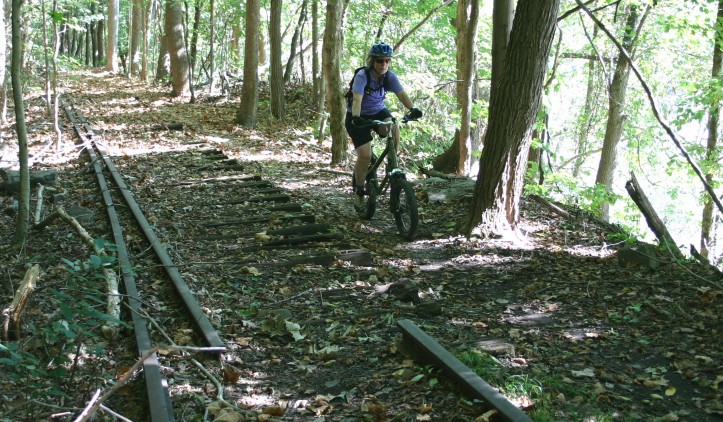
A forest of large oak trees, rhododendrons and evergreens envelopes you while you travel the meandering trail along the bank of the river. One of the most popular among the area’s many trails, this is particularly attractive to mountain bikers who enjoy the rough riding provided by exposed railroad ties along its route.
Beginning at the Brooklyn trail head, head south along the New River. Listen for the exuberant screams of whitewater rafters on the water, one of the finest whitewater rivers in the eastern United States. Active railroad tracks at Southside Junction signal the temporary end of the trail. While the trail extends past these tracks to a trail head at Southside Junction, a legal (and safe) crossing here is currently not available. According to the National Park Service, negotiations are underway, but in the interim, please respect this private property and keep clear of the tracks.
Trail Manager Contact
United State National Park Service New River Gorge National River
Post Office Box 246
Glen Jean, West Virginia
304-465-0508
Notes
New River Gorge National River- Thurmond – Stone Cliff Area http://www.newriverwv.com/Recreation_Hiking_Trails_Brooklyn_Southside_Junction_Trail.php
https://www.nps.gov/neri/index.htm