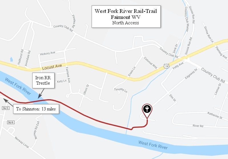
Click on on the above map for a larger image
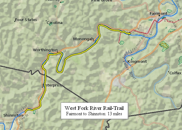
West Virginia’s West Fork River Rail-Trail provides a snapshot of some of the most beautiful scenery in this region. The trail’s path was once used by the far-reaching Baltimore & Ohio Railroad to deliver coal. Today’s plans however, are to transport people and link this rail-trail to the American Discovery Trail. The eastern portion of the West Fork River Trail through Marion County is paved; its western end in Harrison County has a crushed limestone surface.
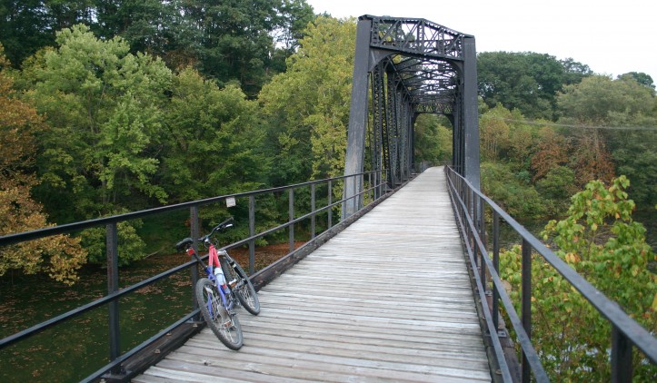
Shortly after its start in picturesque Shinnston, the trail reaches the rippling West Fork River and its cliffs and forests. Close to the Harrison and Marion county border, you will pass a historical railroad bridge that spans the river. The trail travels through some wooded passages and then it opens up to a park, where children play baseball and softball and fishermen vie for the prized catch below the dam.
A few miles beyond the park you cross a railroad bridge and return to the wooded haven of the trail. At the town of Norway, you have the option of going another 0.5 mile to a stunning wooden bridge, or you can continue past the bridge to the Mary Lou Retton Youth Park, which offers recreational fields, parking, restrooms and the West Virginia Miners Memorial. Pay close attention for the turnoff for the park: heading toward Fairmont, the turnoff is on the right. After turning off the trail, turn left to reach the park on the paved road (unmarked County Road 56/6), and then take a quick right uphill on unmarked Norway Road through the little town of Norway.
Trail Manager Contact
Marion County Recreation and Parks Commission (MCPARC)
Marion County Parks and Recreation Commission
1000 Cole Street
Suite B
Pleasant Valley, West Virginia
304-363-7037
http://www.mcparc.com/
MCPARCFUN@aol.com
Notes
National Recreation Trail and part of the planned Parkersburg to Pittsburgh Trail corridor, Industrial Heartland Trails Coalition
City of Shinnston: http://www.shinnstonwv.com/index.cfm/parks-events/west-fork-river-rail-trail/
Marion County Recreation and Parks Commission: http://www.mcparc.com/rail-trails.html